
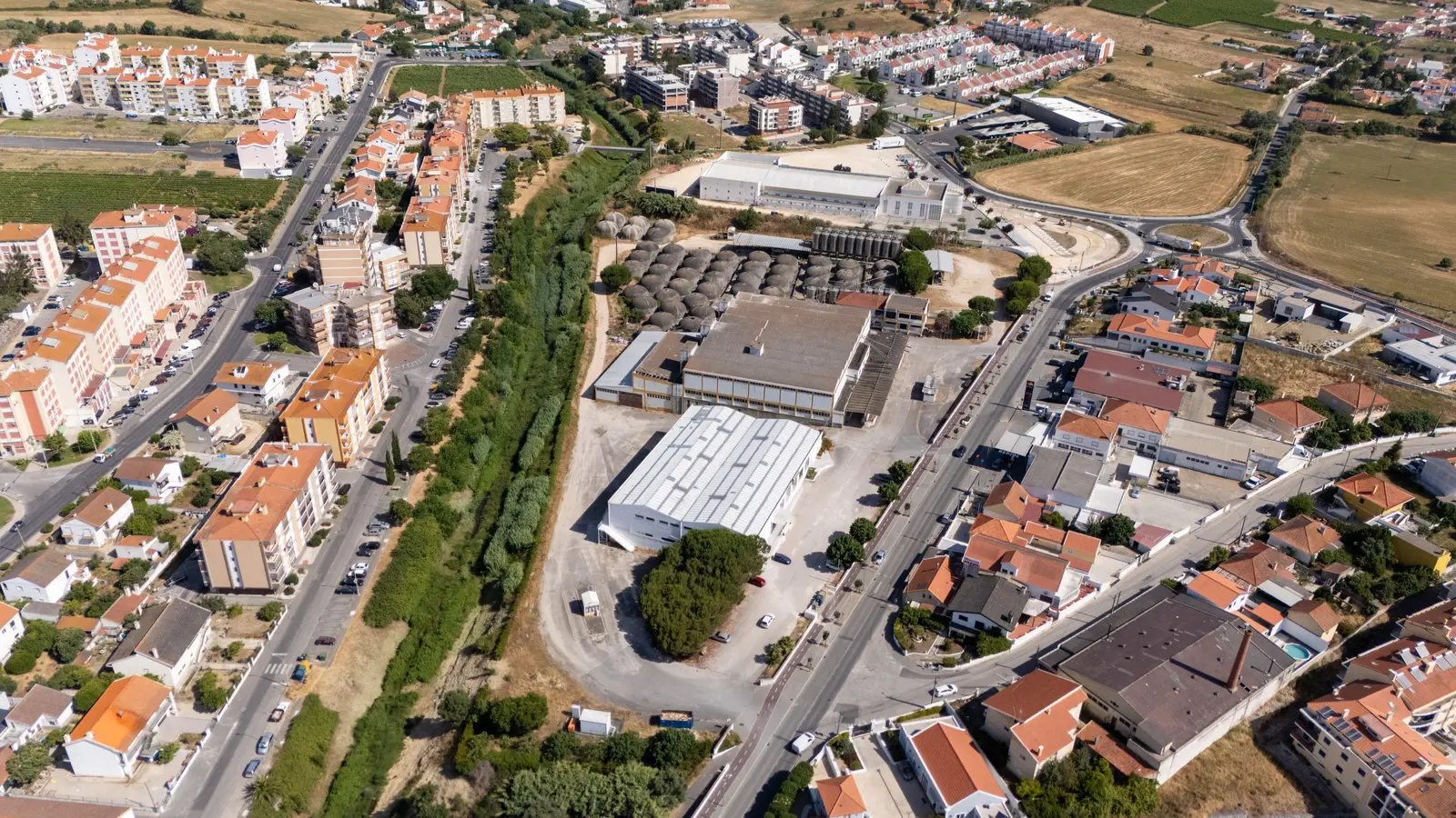
Drone in real estate video: when it adds value
When a drone adds real value to real estate video, when it does not, and what EU and Portuguese drone rules mean for planning an aerial property shoot.
- 01
A drone is worth using when it shows land, setting, access or scale that ground footage cannot.
- 02
EU drone rules and Portuguese requirements, including geographical zones and image capture authorisation, must be checked before aerial footage is promised.
- 03
Aerial shots work best as punctuation in the film: opening, transitions and closing.
- 04
When a flight is not viable, higher vantage points, ground sequences and map graphics can carry the context.
Quick answer
A drone adds value to real estate video when it shows something the ground camera cannot: the plot and its boundaries, the setting, access, a view or the scale of a building in its landscape. For an apartment whose value is inside, aerial footage usually adds little. In Portugal, every flight also depends on the location, the airspace rules and the authorisations that apply, so feasibility must be confirmed before a drone is promised.
A drone can place a property in context within seconds, but it does not automatically improve a production. Aerial imagery earns its place when it answers a question a buyer, tenant or guest would ask. This guide explains how we decide, what the rules mean in practice and how aerial shots fit into a property film.
When a drone is useful
Some properties are hard to understand from eye level. In these cases an aerial reading saves the viewer time and often answers questions that would otherwise need a visit.
Land, farms and rural properties
On a large plot, the most important information is often where the boundaries are, how the land slopes, where the house sits and how the outbuildings, wells, vines or orchards relate to each other. A short aerial sequence can explain all of that in a way that a plan alone does not.
Properties defined by their setting
A house facing the sea, a quinta overlooking a valley or a villa next to a golf course is sold partly on its surroundings. Aerial footage shows the direct relationship between the property and the landscape, and the distance to the beach or the village.
Hospitality, resorts and developments
Hotels, holiday complexes, condominiums and new developments usually have several buildings, shared amenities and access roads. From above, a guest or investor understands the layout: where the pool is, how the units are arranged, how parking and gardens work.
Architecture with a strong exterior form
Some buildings are designed to be read as a whole, from the roofline to the way they sit on the land. A slow aerial movement can reveal volume and implantation that ground-level footage only shows in fragments.
When it is not the priority
For an apartment in a dense area without a distinctive view, aerial footage often shows a roof among other roofs. If time or budget is limited, strong interiors, natural light, photography and a clear narrative usually offer more commercial value. Our guide on how to show a property in real estate video explains how we build that sequence.
It is also not the priority when the surroundings work against the property, such as a motorway, an industrial site or a building under construction next door. Showing them from above makes them more prominent, not less.
Ask what the aerial shot needs to prove
Before any flight is planned, we ask one question: what does this shot need to show that nothing else can? If the answer is clear, the shot has a purpose. If the answer is "it looks impressive", it probably belongs to a different project.
| Situation | Likely value | Possible alternative |
|---|---|---|
| Large plot | Boundaries, topography and placement | Map, plan or elevated ground camera |
| Waterfront or notable view | Direct relationship with the surroundings | Ground-level exterior sequence |
| Urban location | Access and proximity | Graphic overlays on contextual footage |
| Resort or development | Layout of buildings and amenities | Site plan with ground footage |
| Interior-led apartment | Often limited | Facade, entrance and stabilised interiors |
What the rules mean for a property shoot
Drone rules in Portugal follow the European framework, with national requirements on top. We are not summarising the law here, and each project is checked against the current rules, but a client should understand why we assess before we promise.
The open category and its limits
According to EASA, the open category is the main reference for leisure flights and low-risk commercial activities. It is divided into three subcategories: A1 allows flying over people but not over assemblies of people, A2 allows flying close to people, and A3 is for flying far from people. Across these subcategories, flights stay below 120 metres above ground level. In A2, for example, the drone must keep a horizontal distance of 30 metres from uninvolved people, which can be reduced to 5 metres with a low-speed function.
In A3, ANAC states that the operation must keep more than 150 metres from residential, commercial, industrial or recreational areas. This matters for property, because many homes sit in or next to exactly those areas. The drone, its class and the location decide which subcategory is possible.
When an operation is riskier than the open category allows, EASA explains that the specific category requires an operational authorisation from the national aviation authority before flying.
Registration and image capture authorisation
ANAC requires registration as a UAS operator in the open category when the fleet includes a drone over 250 g or a drone with a camera or other sensor able to capture personal data, with limited exceptions. On image capture specifically, ANAC notes that for aerial surveys an authorisation must always be requested from the National Aeronautical Authority (Autoridade Aeronáutica Nacional).
Geographical zones
Portuguese airspace includes geographical zones established for safety, security, privacy or environmental reasons. ANAC asks operators to consult these zones before starting an operation. Some zones restrict or prohibit flights, and a property inside or next to one may need extra steps or a different plan.
Weather, light and privacy
Even when everything is authorised, conditions decide the day. Wind, rain, low cloud and poor visibility can cancel a flight that was planned for weeks. A good schedule includes an alternative window, and the ground shoot should not depend on the drone happening on the same morning.
Light matters as much from above as from the ground. A facade that faces west may look flat in the morning and warm in the late afternoon. We plan aerial shots for the time that suits the main elevation and the landscape around it.
Privacy deserves its own check. From above, the camera can see into neighbouring gardens, pools and terraces. We frame to avoid them and talk to the client about neighbours, shared boundaries and anything that should stay out of the film.
Make aerial and ground footage feel like one film
Match light direction, movement and colour so the transition does not feel borrowed from another production. An aerial shot can establish context, while eye-level images communicate materials, entrance and lived experience.
Use aerial shots as punctuation
In most property films, aerial footage works best at three moments: the opening, to place the property; a transition, to move from the house to the garden or the land; and the closing, to return to the setting. Long sequences of similar flights slow the film and tell the viewer nothing new.
Plan for every format
A wide aerial shot that works in 16:9 may lose its subject in a 9:16 vertical cut. If the film will also be used in reels and stories, we frame with room to crop, or plan specific vertical movements.
FPV is a different tool
Two members of our team, Luís Pereira and Diogo Pereira, are FPV pilots. A first-person-view flight can travel through a space in one continuous movement, which suits some properties and venues. It is a different decision from a conventional aerial shot, with its own assessment, and it is not right for every home.
When the drone is not viable
Sometimes the answer is no: the zone does not allow it, the neighbours are too close, or the forecast closes the only available window. That does not mean the context is lost. Other tools can carry part of the job:
- A wide shot from a higher point nearby, such as a terrace, a hill or a public viewpoint, with permission where needed.
- A slow ground-level sequence from the street to the entrance that shows access and neighbourhood.
- A simple map or site plan graphic in the edit to show location and boundaries.
- Photographs of the view taken from inside the property, which often sell it better than the view of the roof.
Information needed for an early assessment
- Exact address and coordinates.
- Property type, height and surroundings.
- The intended purpose of aerial footage.
- Preferred date and an alternative window.
- Expected presence of people or vehicles.
- Known restrictions at the location.
- Relationship with neighbours and adjacent property.
- Required horizontal and vertical formats.
Prepare the exterior as you would for any shoot. Vehicles, equipment, garden waste and technical areas become more visible from above. Our checklist for preparing a property for video and photography covers the details.
Common mistakes
- Selling aerial footage to the owner before checking whether the flight is viable.
- Using the same slow orbit on every property, whatever its story.
- Flying at midday because it fits the agenda, not because it suits the light.
- Ignoring neighbours and shared boundaries in the frame.
- Ending up with aerial shots that do not match the colour and pace of the rest of the film.
How DropMedia decides
We treat a drone as a context tool, not a standard item. In pre-production we review the address, the goal and the surroundings, check the applicable rules and zones, and tell the client whether aerial footage adds information, what the alternatives are and what could change on the day. If it is not justified, we say so and put the time into interiors and exteriors at ground level.
You can see examples of our real estate visuals or read about the full commercial process, from briefing to delivery.
References
- EASA: Open category, low-risk civil drones
- EASA: Specific category civil drones
- ANAC: Open subcategory A3
- ANAC: Do I need to register as an operator?
- ANAC: Open subcategory A1
- ANAC: Geographical zones and U-space airspace
Frequently asked questions
Can a drone be used at every property?
No. The location, geographical zones, nearby people and buildings, privacy, weather and the authorisations that apply all need to be checked before a flight is confirmed.
Does a drone replace ground-level exterior footage?
No. Aerial shots establish context and scale, while eye-level shots show materials, entrance and how the property feels. Most films need both.
What happens if the weather is bad on the day?
Wind, rain, low cloud or poor visibility can cancel a flight. We plan an alternative window for aerial work so the ground shoot does not depend on it.
Is aerial footage worth it for a city apartment?
Usually not, unless the building, the view or the location is the main selling point. Strong interiors, light and photography normally deliver more for the same time and budget.
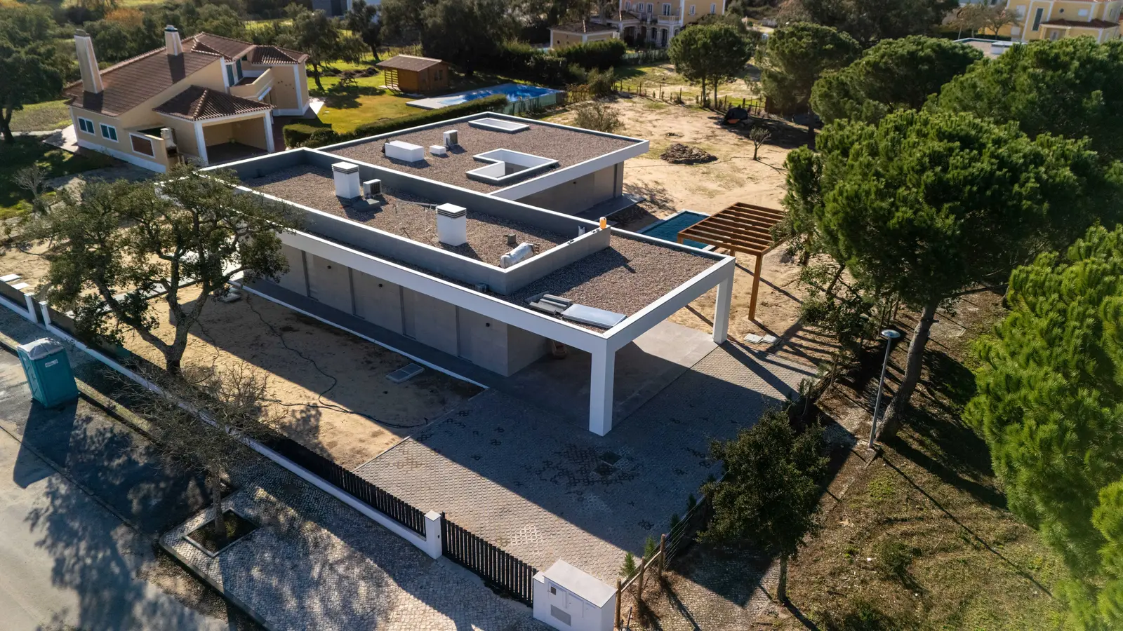 Real Estate
Real estate video: how to show a property without losing context
Plan real estate video with context, natural light, honest lenses and the right formats for listings and social, without creating false expectations.
- real estate video
- property photography
- architecture
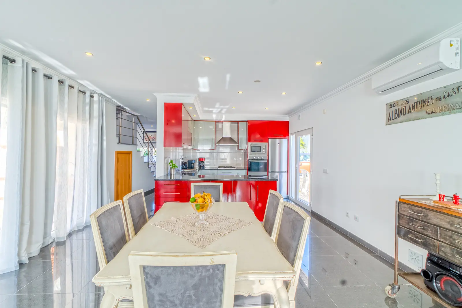 Real Estate
Checklist for preparing a property for video and photography
A practical checklist to prepare a property for video and photography: staging, exterior, privacy, light, access and how to organise the shoot day.
- prepare property
- property photography
- real estate video
 Strategy
Company film: how to turn a business into a clear story
A practical guide to a company film with one audience, one central idea, real evidence, useful interviews and versions planned for every channel you use.
- company film
- corporate video
- business storytelling